More maps from the University of Hawaii at Manoa Library, 1540–1994.

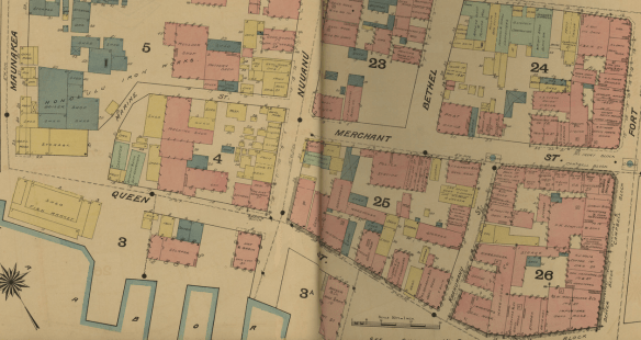
Restored Maps from the Flood of 2004.

This is a collection of just a few of the many maps which were damaged by the flooding of Hamilton Library back in 2004 and which were subsequently cleaned and restored. They feature maps of the world including some of Hawaii nei.

Maps, courtesy of the University of Hawaii at Manoa Library, 1891–1906.

Dakin Fire Insurance Maps

Here are more helpful digital images put up by the University of Hawaii at Manoa Library System! They are fire insurance maps done at the turn of the century, and give you a better picture of what the streets of Honolulu looked like back then.

[It would be ideal if these maps could be unbound so that clearer images of the entire area could be made, not unlike the bound newspapers that i keep talking about…]